
Everything you check before you cast off, and what you do next.
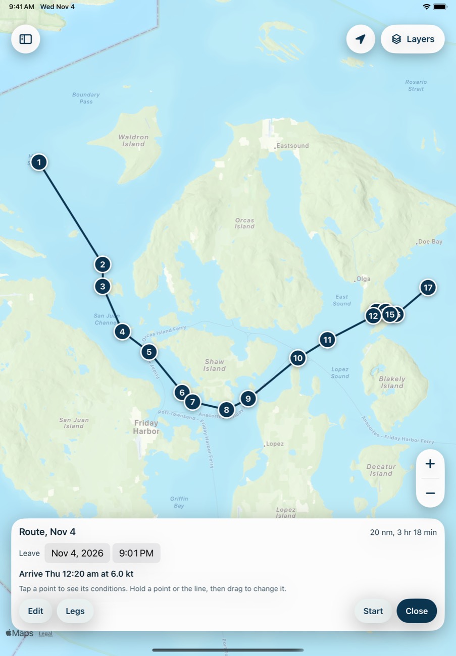
Routes that go around the land
Tap a start and an end. It finds the shortest way clear of land, shallows and charted hazards. Rather go south of the island? Drag it and recalculate.
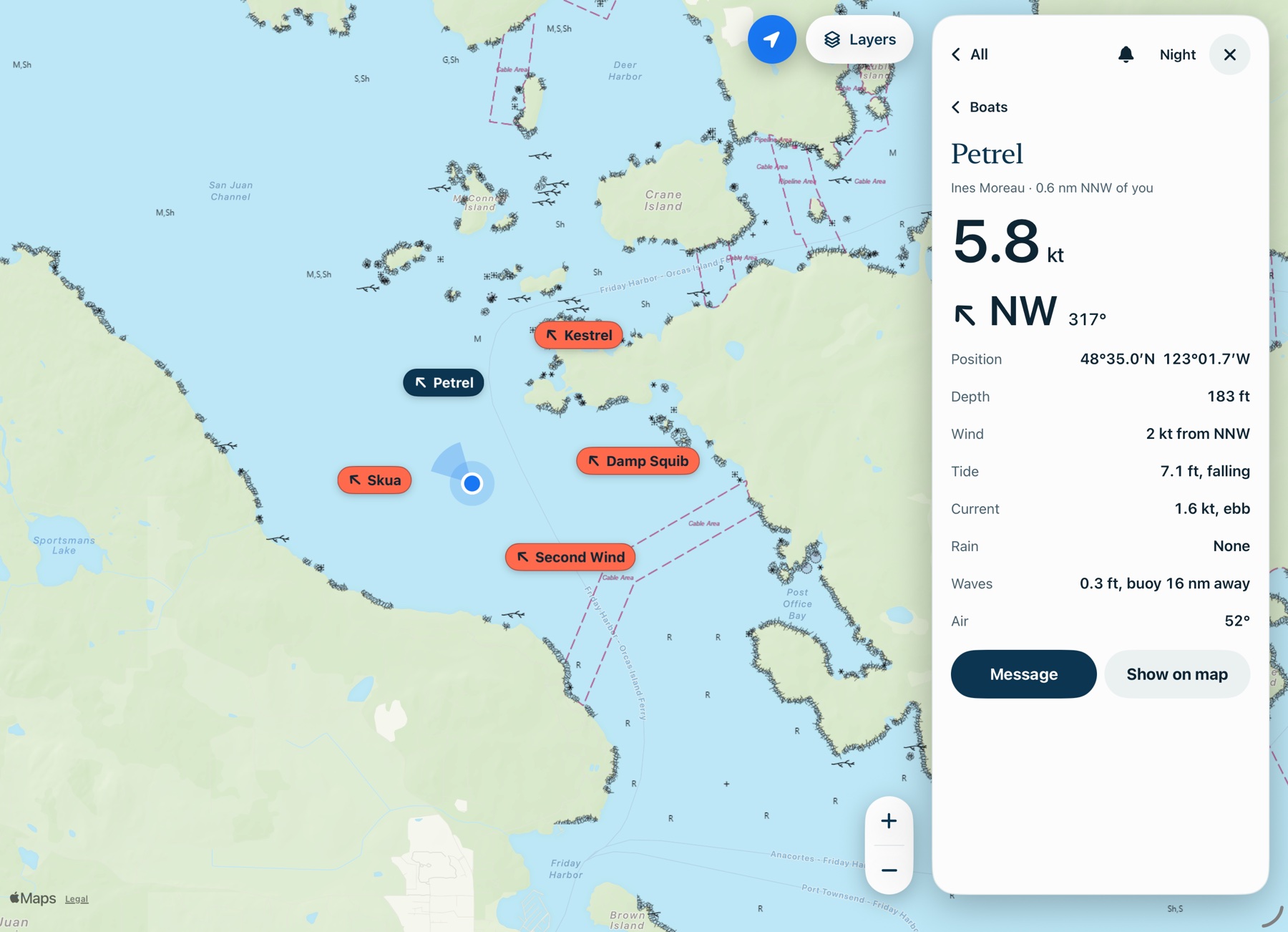
See and talk to every boat in your fleet
Every boat on your map by name, with its position, speed and depth. Message the whole fleet or just one boat, with quick replies like "All OK?" and "Anchoring here".
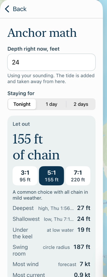
Anchor math with the real tide
How much chain for 3:1, 5:1 or 7:1, using the highest tide during your stay. Plus what's under your keel at low water and your swing room.
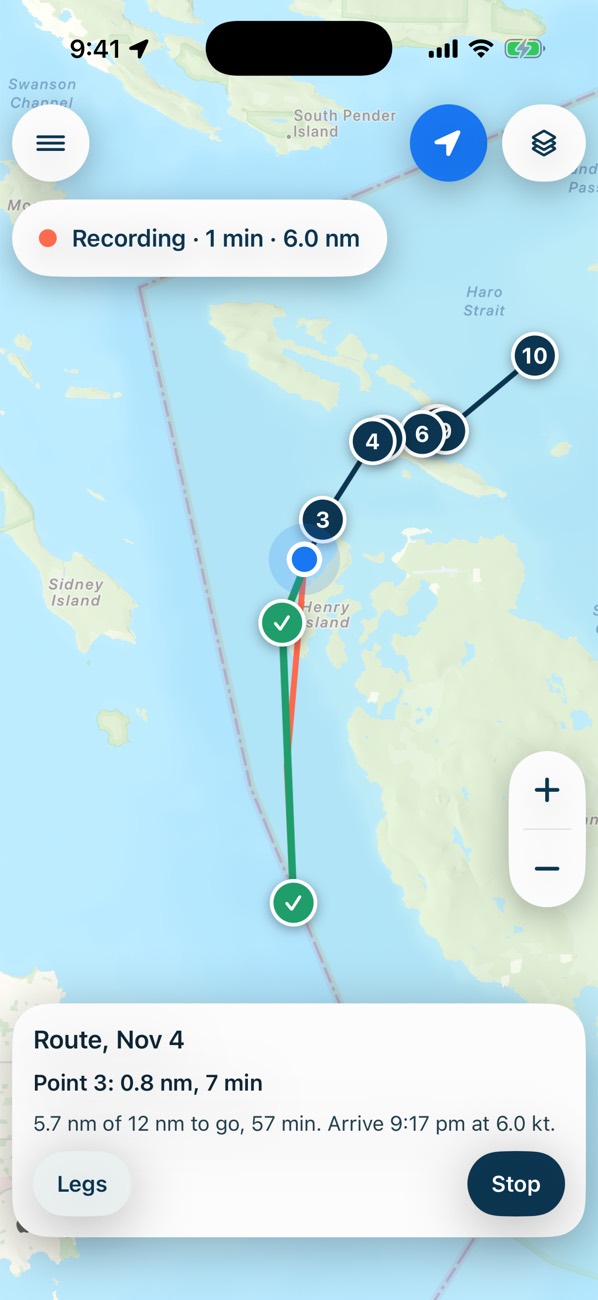
Arrival times, leg by leg
Pick a leaving time and see when you'll get there. Follow along as the route turns green and points get a check mark.
When the water isn't following the table
Tide tables are predictions. It compares them with the nearest NOAA gauge, and tells you when the water is running high or low.
What other boaters learned
Where to anchor and what to avoid, pinned to the spot, with the wind, tide and depth from that day.
See how each one works in the tutorials

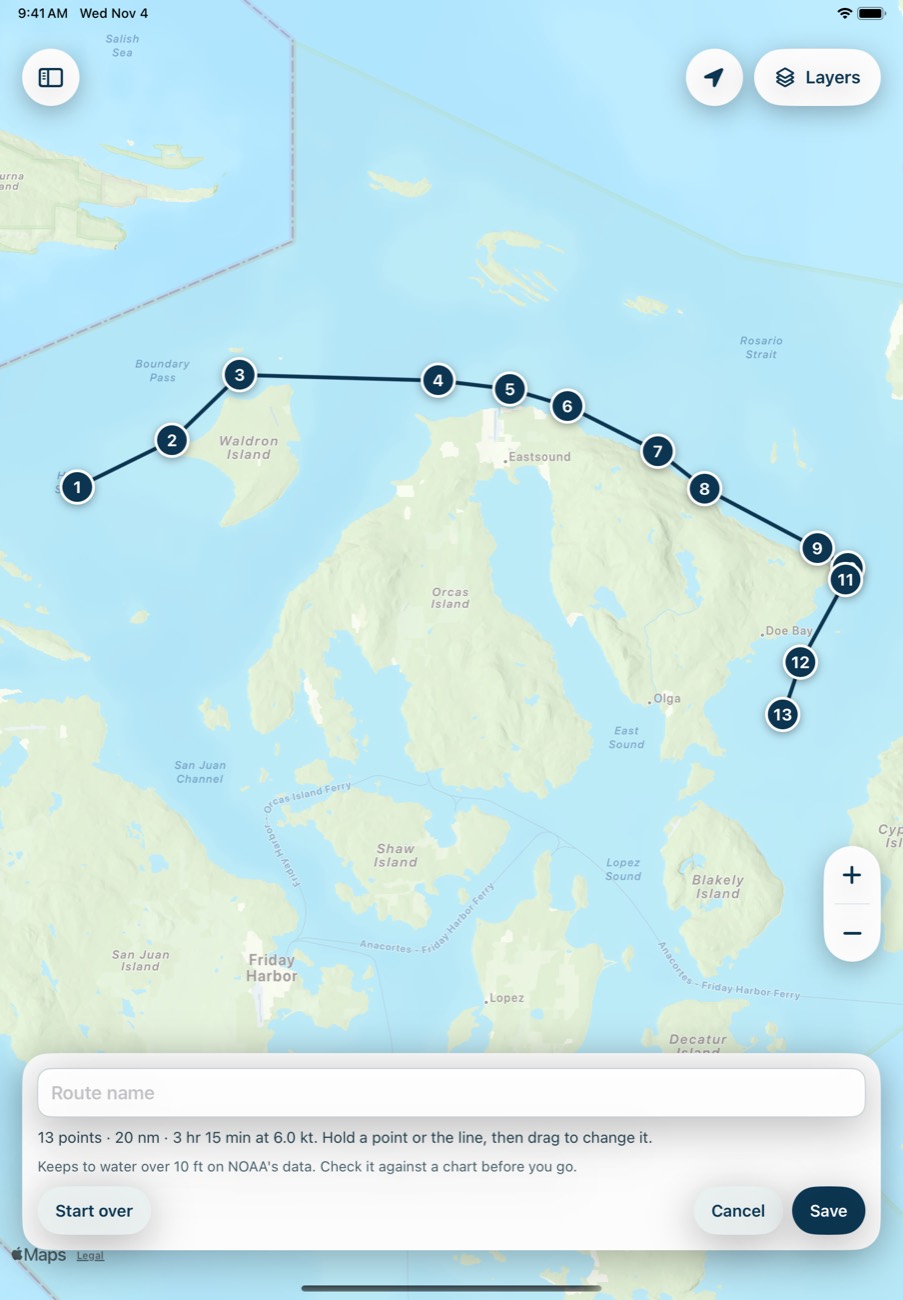
Tap where you are. Tap where you're going.
Breaking Wind finds the shortest way between them, around land, water under your minimum depth and NOAA's charted rocks, wrecks and obstructions.
Prefer the south side of the island? Hold a point or the line, drag it there and tap Recalculate. It keeps the points you moved and works out the rest.
A planning aid, built from public data. Check it against a chart before you go.
Know when you'll get there, and how far you've come.
Choose a leaving time and see your arrival, with the distance, direction and time for every leg.
Tap Start, and the route you've finished turns green, with a check mark on every point you pass. The next point, what's left and your arrival stay on screen.
Send the route to your fleet, so everyone's working from the same plan.
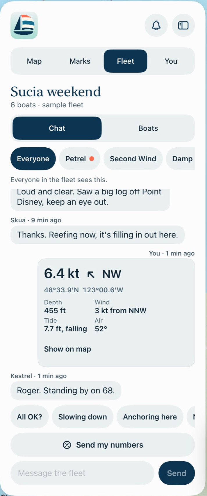
Know what every boat in your group is doing.
Sailing with friends or a club usually means calling for positions on the radio and hoping someone wrote them down. A fleet puts everyone on your map, with their numbers one tap away.
How it works
- Start a fleet. Name it and send your group the invite. Five or six boats is the idea.
- See everyone. Each boat appears on your map by name, wherever it is in the group.
- Talk to the fleet, or to one boat. Message everyone, or pick a vessel for a private word. Quick replies like "All OK?" and "Anchoring here" take one tap.
- Send a route. Share a saved route with the fleet, so everyone's working from the same plan.
- Share your numbers. One tap sends your speed, direction, position, depth, wind and tide as a card, and anyone can open it on the map.
You choose what's shared. Turn off sharing and your boat leaves everyone's map, and nobody outside your fleet can see any of it.
Fleets need a cell or Wi-Fi connection, and don't replace VHF. They aren't for emergencies.
How much chain, for the tide you'll actually have.
Enter your sounding and how long you're staying. It finds the highest tide during your stay and works out the chain for 3:1, 5:1 and 7:1.
You also see what's under your keel at low water, how much swing room you need, and the wind and current forecast while you're there.
Measured, not just predicted. Wind and pressure can push the water away from the tide table. Breaking Wind checks the nearest NOAA gauge and tells you when the water is running above or below the prediction.
Start with a clean map. Add only what you need.
Depth, bathymetry, wind, current, waves, rain, temperature and NOAA chart symbols are all one switch away, and all off until you want them.

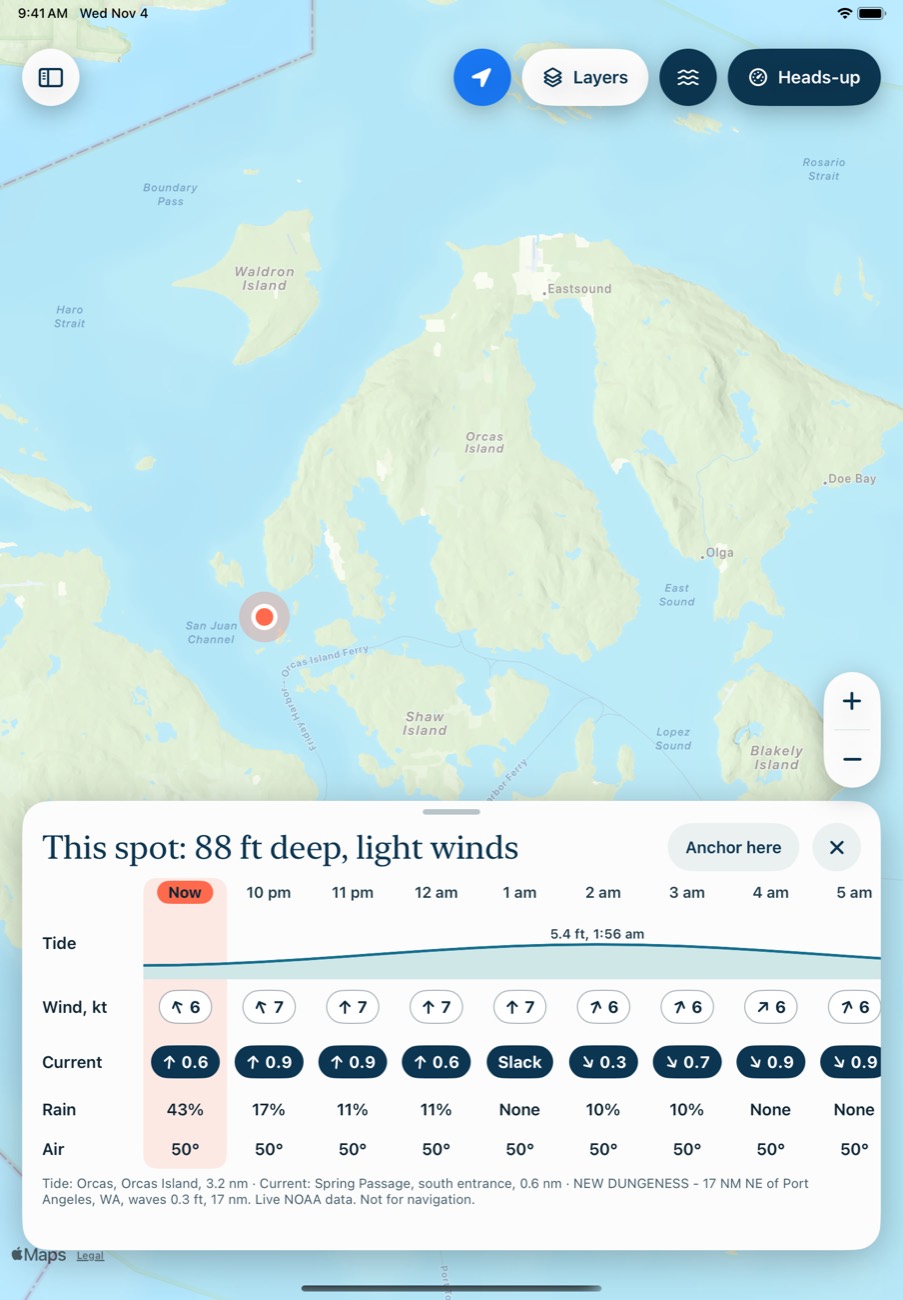
Tap the water. Read the spot.
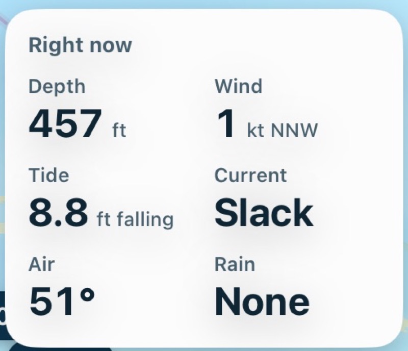
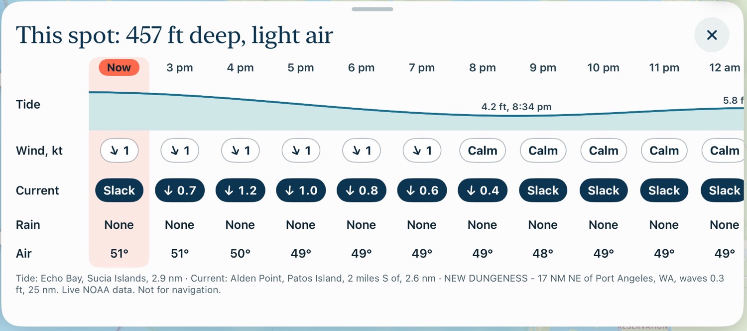
Before you commit to a passage or an anchorage, tap it. Depth, wind, tide, current, air and rain for that exact place, then hour by hour for the day ahead.
Slide to 3 pm and everything on the map moves to 3 pm with it.
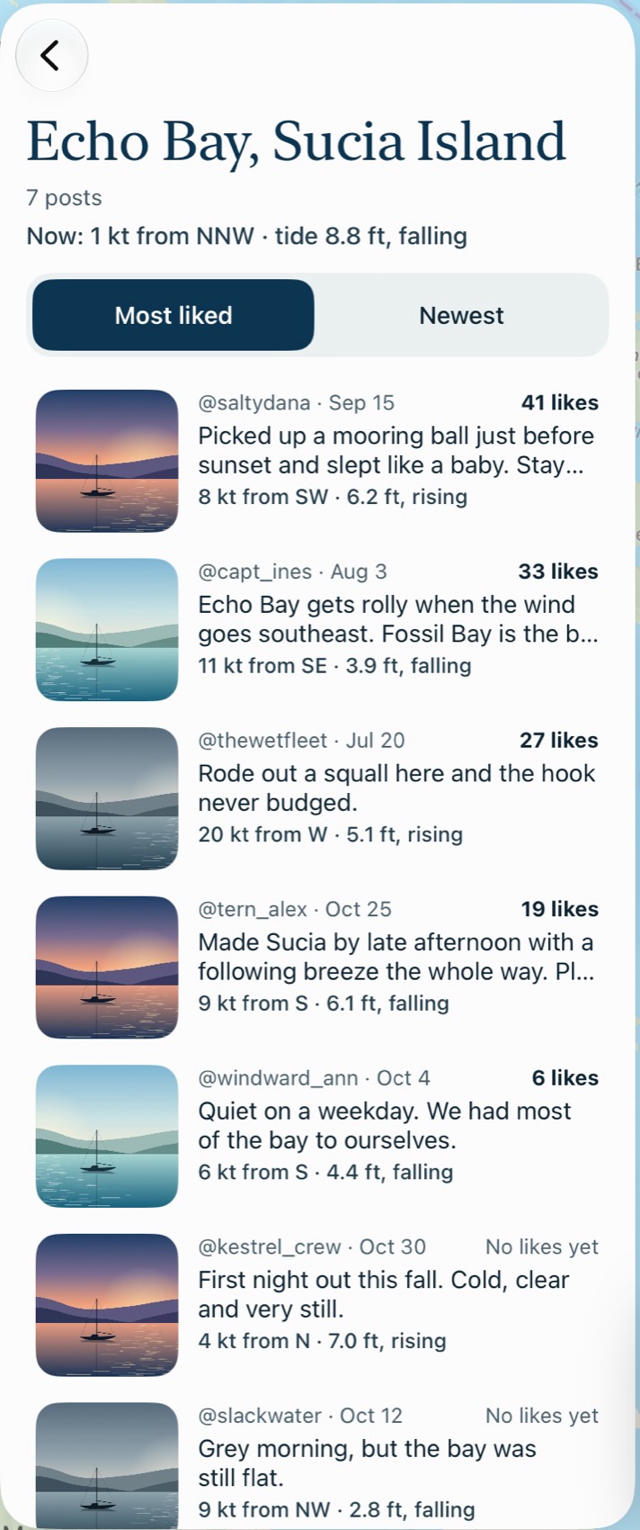
What other boaters learned, pinned to the spot.
The rock at the bay entrance. The cove that gets rolly in a southeasterly. The mooring ball worth racing for.
- The conditions come with it. Every post keeps the wind, tide and depth from that moment, next to what they are now.
- The useful ones rise. Posts sort by most liked, or switch to newest.
- Your trips stay yours. Trips are private. Posts are public, so think before you post.
Posts shown are samples.
Every number you check before you cast off.
Straight from NOAA, the National Weather Service and the National Data Buoy Center. All of it in one place, so you stop switching apps.
- DepthAt any spot you tap, and at your position underway
- BathymetryThe sea floor in relief, with contours and soundings
- TidesHighs, lows and the curve, from the nearest station
- CurrentsSpeed, direction, flood, ebb and slack
- WindSpeed and direction, hour by hour
- WavesLatest readings from the nearest buoy
- Rain and air temperatureHourly forecasts for the spot
- Water temperatureFrom the nearest buoy that reports it
- Chart symbolsNOAA's rocks, wrecks and obstructions

Where it works
All US waters for tides, currents, forecasts and depth. In Canada, forecasts from Environment and Climate Change Canada so far.
What you'll need
An iPhone or iPad. On the water it needs a GPS position. iPhones and cellular iPads have GPS built in. Wi-Fi iPads don't, so they need a connected GPS.
Fair questions.
When is it out?
There's no date yet. Join the list and we'll email you when there's a beta spot, and at launch.
What does it cost?
There will be an inexpensive subscription, bought through Apple. We haven't set the price yet.
Does it track me or show ads?
No third-party tracking, no ad SDKs and no sponsored content. Read the privacy policy for what the app does keep.
Who can see where I am?
Nobody, unless you choose it. Trips are private. Posts are public as soon as you post them. Your position goes to a fleet only while you're sharing with that fleet.
Will my data go if I stop subscribing?
No. You keep your own data and can still export it if you cancel.
Is it really called that?
It is. Say it out loud at the marina once and you won't forget it.
Be first on the water with it.
Early access goes to people on this list first.