
Open the heads-up view
Tap Heads-up at the top right. On a phone it's the gauge icon. It also opens if you start a trip from the Map tab. To close it, tap the X or swipe right.
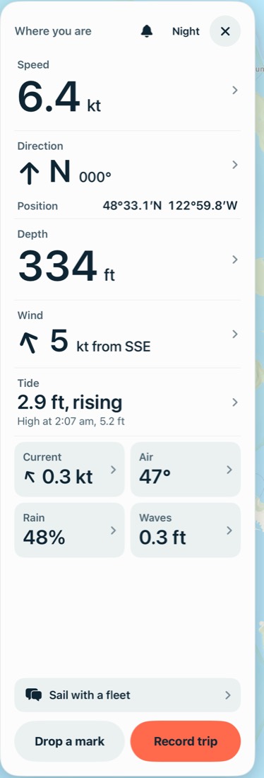
The title says what it's showing: Where you are, Where the map is if you have no position, or This spot if you've tapped one. Tap Clear to go back.
Tap a number for more
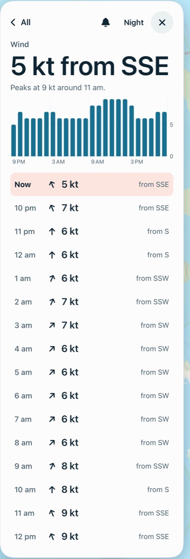
Opening a detail also shows its layer on the map until you tap All. Tap a row in an hourly list to move the map to that hour.
| Number | What you get |
|---|---|
| Speed and Direction | Speed and heading, plus distance and time if you're recording |
| Depth | Tints the map, with a key and a reminder that it's an estimate |
| Wind | The peak, a chart and an hourly list |
| Tide | A chart, the next four highs and lows, and the station |
| Current | Flood or ebb, a chart and an hourly list |
| Air | High and low, a chart and an hourly list |
| Rain | The wettest hour, a chart and an hourly list |
| Waves | Height, period, water temperature and which buoy |
Position isn't tappable. It's shown in degrees and decimal minutes, the way a chart plotter or a radio call gives it.
Night mode
Tap Night for darker colors. It applies while the heads-up view is open, and goes back to day the next time you open the app.
The rest of the panel
- The bell turns the obstacle alarm on or off. See Underway alerts.
- The fleet row opens your fleet and shows new messages.
- Drop a mark marks where you are.
- Record trip and Stop trip start and end a recording.
Record a trip
- Tap Record trip on the Map tab or in the heads-up view. It needs a GPS position.
- A pill shows the time and distance so far, such as "Recording · 12 min · 1.4 nm". Tap it to open the heads-up view.
- Tap Stop trip in the heads-up view when you're done.
Your track draws on the map in coral. Trips only record when you start one, and keep the app open while recording, because a recording is lost if the app is force-quit. A trip with almost no movement isn't saved.
Look back at a trip
Go to You, then Trips. Opening one draws its track on the map and shows the distance, time, average and top speed, a speed chart and any marks from that trip. Delete trip removes it for good. Trips are private: only you can see them.
Common problems
Speed and direction show "--".
There's no GPS position yet. Tap Use GPS, and check that location is allowed. A Wi-Fi iPad needs a connected GPS.
It says some data is from another source.
NOAA isn't answering, so the app used another source. The note names it.
My trip wasn't saved.
It needs some movement, about 30 ft, to be saved. A recording is also lost if the app is force-quit before you stop it.
Next: Plan and follow a route